Category: Travel Guide

Travel guides to popular places in working holiday countries.

  • 6 Best Places to Visit in Chile

    6 Best Places to Visit in Chile

    Torres del Paine National Park
    Torres del Paine National Park

    Stretching some 4,300 km, Chile holds Patagonian granite, the driest desert, the moai of a remote Pacific island and a colourful port city. Here are 6 of the best places to visit on your days off or travels during a working holiday.

    Torres del Paine National Park
    No.1

    Torres del Paine National Park

    In Chilean Patagonia, Torres del Paine is a dream for hikers worldwide: three granite towers, the horn-shaped Cuernos, emerald glacial lakes, herds o…

    Getting there:About 3.5 hours by air from Santiago to Punta Arenas; 2 hours by bus from Puerto Natales

    Read the full guide →
    The Atacama Desert
    No.2

    The Atacama Desert

    Northern Chile’s Atacama is one of the driest deserts on earth. A lunar Valley of the Moon, flamingos on salt lakes, dawn geysers and some of the wor…

    Getting there:About 2 hours by air from Santiago to Calama, then 1.5 hours by bus

    Read the full guide →
    Easter Island (Rapa Nui)
    No.3

    Easter Island (Rapa Nui)

    Some 3,700 km from mainland Chile, Easter Island (Rapa Nui) is home to around 900 giant moai statues, still wrapped in mystery. Sunrise behind the 15…

    Getting there:About 5 hours by air from Santiago

    Read the full guide →
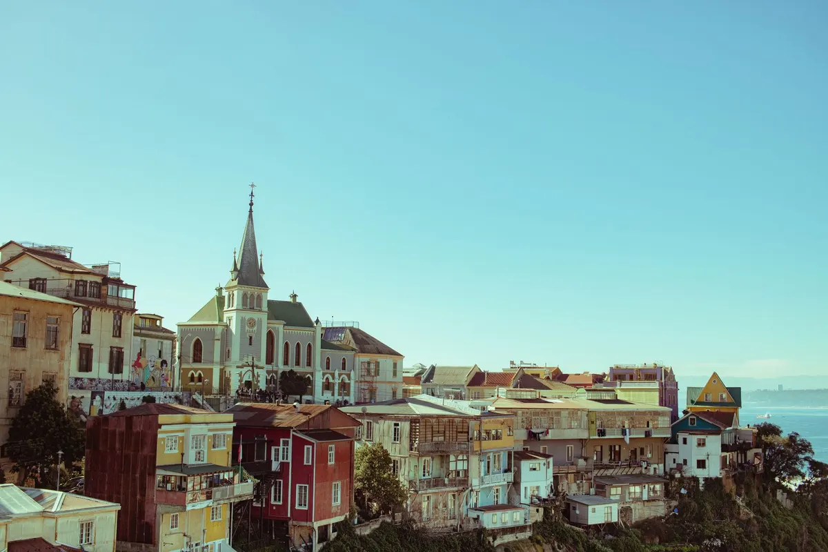
    Valparaíso
    No.4

    Valparaíso

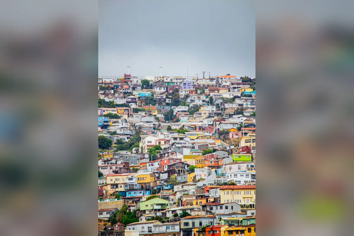
    On the Pacific, Valparaíso’s colourful houses cling to dozens of hills in a World Heritage port city. Ride old funiculars called ascensores, admire s…

    Getting there:About 1.5 hours by bus from Santiago

    Read the full guide →
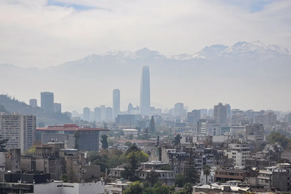
    Santiago
    No.5

    Santiago

    Chile’s capital beneath the Andes, famous for views from Cerro San Cristóbal and seafood at the Central Market.

    Getting there:About 30 minutes by road from Santiago’s international airport
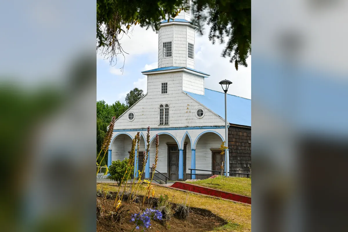
    Chiloé Island
    No.6

    Chiloé Island

    A mystical island of colourful World Heritage wooden churches and stilt houses called palafitos.

    Getting there:About 2 hours by bus and ferry from Puerto Montt

    FAQ

    What are the most popular places?

    Torres del Paine, the Atacama and Easter Island.

    How do I get around?

    Combine domestic flights and long-distance buses.

    When is the best time to travel?

    Patagonia October–April; the Atacama year-round.

    What about seasons?

    It is the southern hemisphere — seasons are reversed from Japan.

    Planning a working holiday in Chile?Visa basics and a take-home pay calculator.
    Chile guide →

    Photos: Pexels
  • Valparaíso Travel Guide

    Valparaíso Travel Guide

    Hills and sea
    Hills and sea

    On the Pacific, Valparaíso’s colourful houses cling to dozens of hills in a World Heritage port city. Ride old funiculars called ascensores, admire street art everywhere and visit poet Pablo Neruda’s house — every walk brings a discovery.

    LocationCentral Chile on the Pacific
    Getting thereAbout 1.5 hours by bus from Santiago
    Best timeOctober–April
    Time needed1–2 days

    How to get there

    1. Frequent buses from Santiago take about 1.5 hours.
    2. The resort of Viña del Mar is about 20 minutes by commuter train.
    3. Ride ascensores or climb the steep streets to the hills.
    4. New Year’s Eve fireworks are among South America’s biggest — expect crowds.

    Opening hours, prices and practical info

    World HeritageHistoric Quarter of the Seaport City of Valparaíso (2003)
    AscensoresSmall fee
    BusAbout 1.5 hours from Santiago
    Neruda’s houseLa Sebastiana (paid)

    Prices and hours are from official sources as of November 2026 and may change — check the official website before you go.

    Highlights of Valparaíso

    Colourful hillsides

    Cerro Concepción and Cerro Alegre are lined with colourful houses and cafés.

    Colourful houses on a hill
    Colourful houses on a hill

    The ascensores

    Century-old funiculars ride up and down the steep slopes.

    Street art

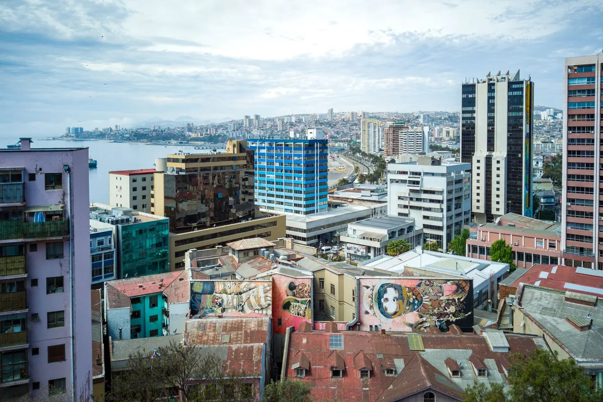
    Walls and stairways burst with murals.

    City streets with street art
    City streets with street art

    Views of the port

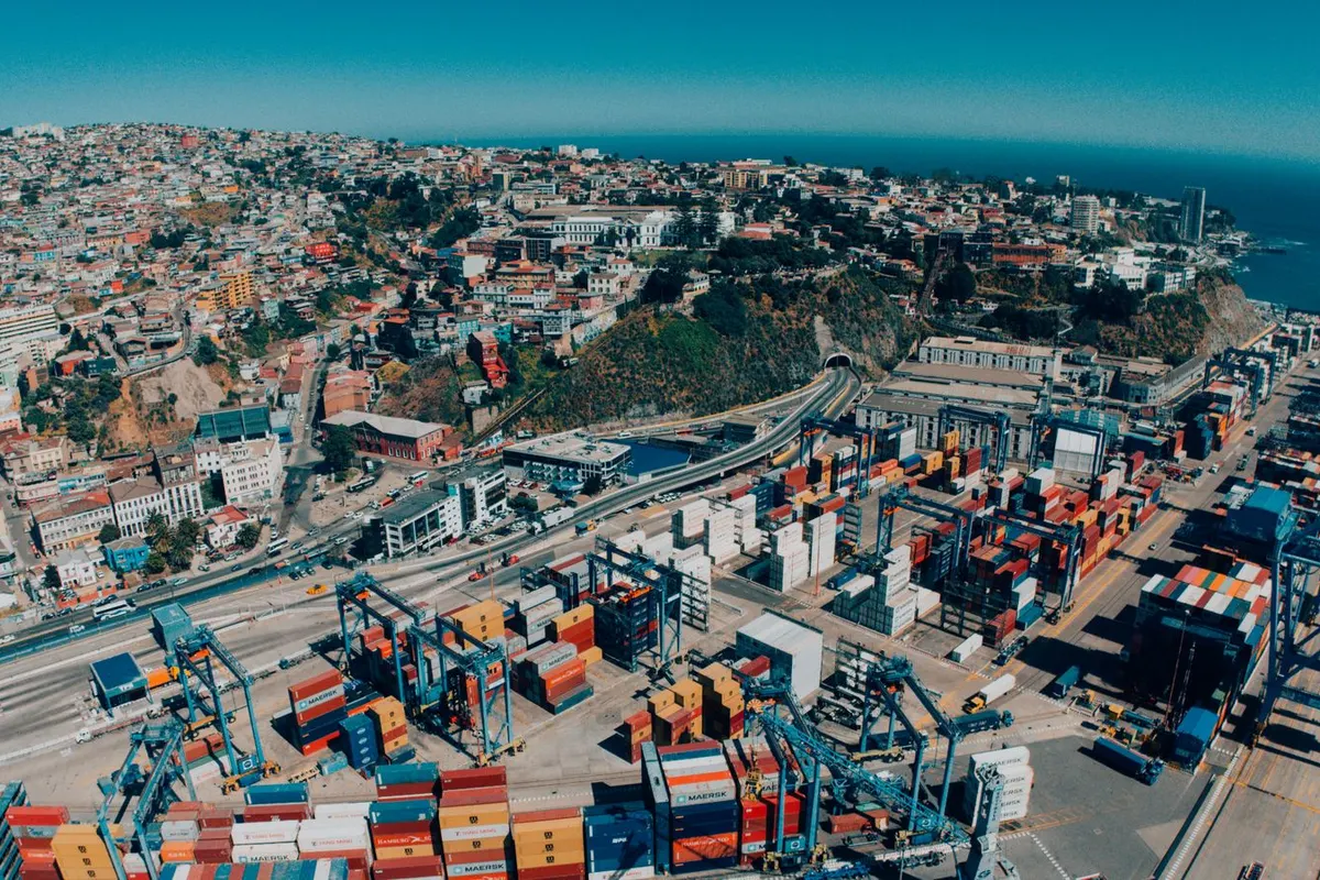
    Hilltop viewpoints overlook the port, ships and Pacific.

    The port from above
    The port from above

    Suggested itinerary

    • Bus from Santiago
    • Plaza Sotomayor and the port
    • Ascensor up to Cerro Concepción
    • Lunch at a hilltop café
    • Street-art walk
    • Neruda’s house, La Sebastiana
    Colourful hillside homes
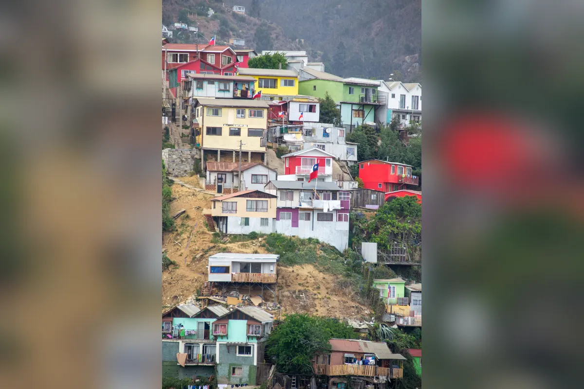
    Colourful hillside homes

    Where to stay nearby

    AREA 1Cerro Concepción and Cerro AlegreBoutique hotels in the most popular hills.
    AREA 2Viña del MarThe neighbouring beach resort.
    AREA 3SantiagoA day-trip base.

    Tips for working holiday makers

    • Expect many hills and stairs — wear good shoes.
    • Take care outside tourist areas and at night.
    • Enjoy fresh seafood in this port city.
    • Chile welcomes working holiday makers, and many learn Spanish there.

    FAQ

    Is it a day trip from Santiago?

    Yes, about 1.5 hours by bus.

    Is it safe?

    Tourist areas are fairly safe; take care at night.

    Which hills should I visit?

    Cerro Concepción and Cerro Alegre.

    Can I add Viña del Mar?

    Yes, 20 minutes by train.

    Planning a working holiday in Chile?Visa basics and a take-home pay calculator.
    Chile guide →

    More places to visit in Chile

    Photos: Pexels (free stock photos) Take-home pay calculator
  • Easter Island (Rapa Nui) Travel Guide

    Easter Island (Rapa Nui) Travel Guide

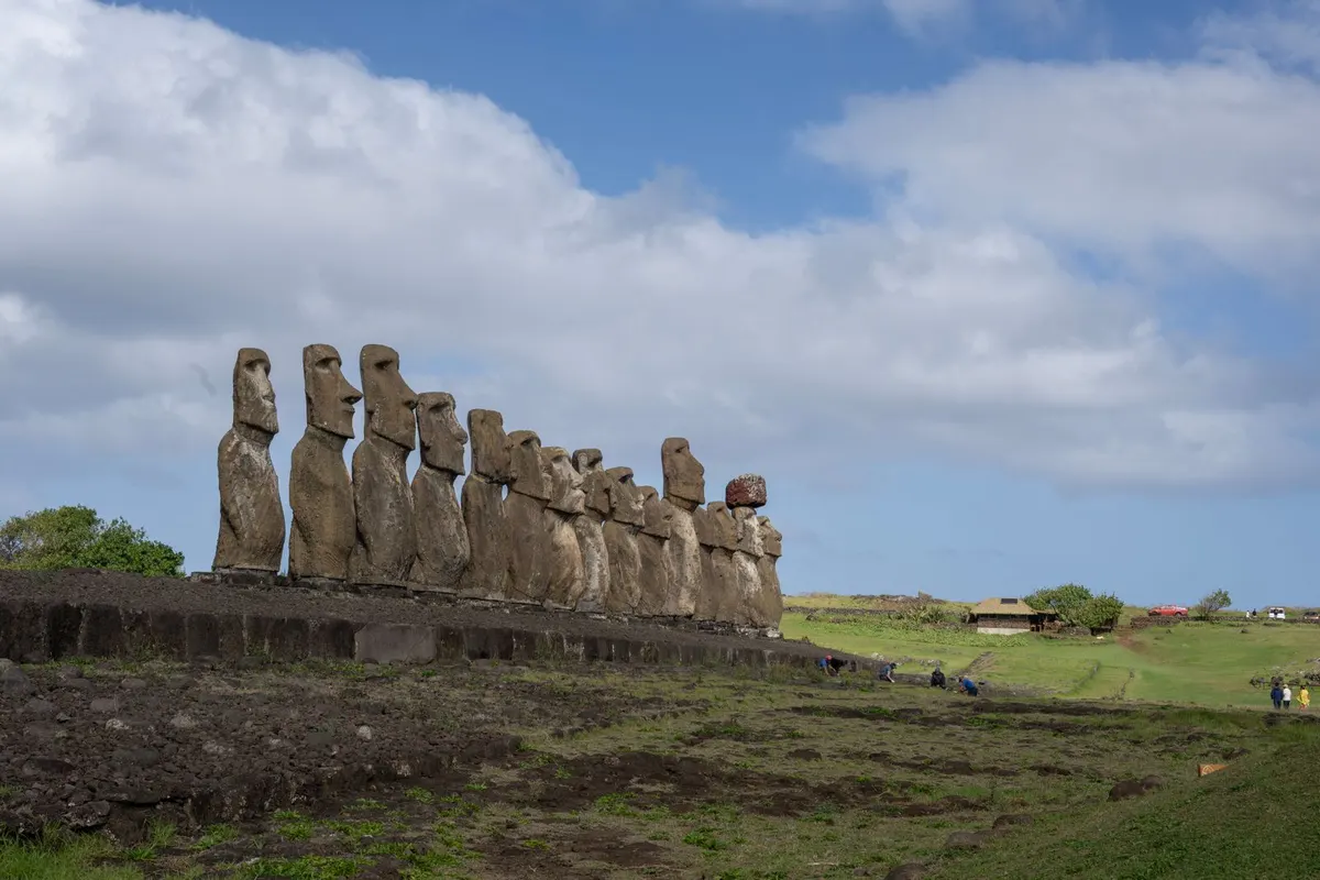
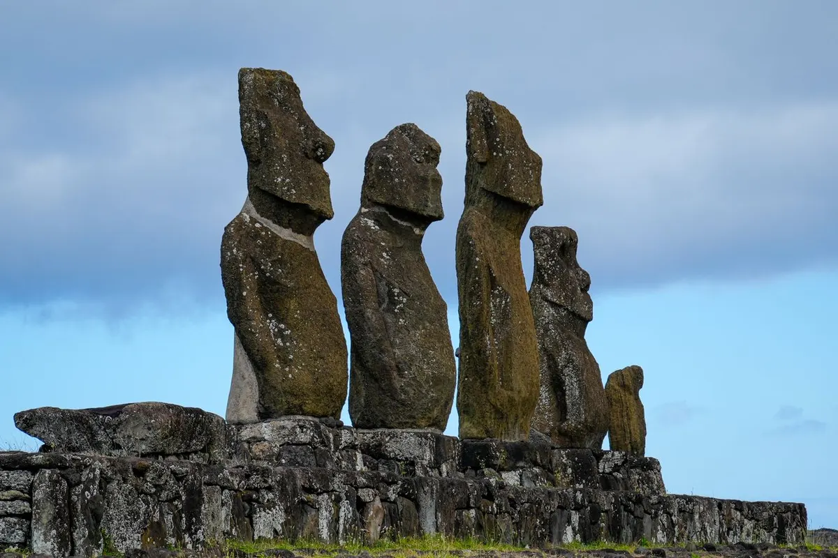
    Moai in a row
    Moai in a row

    Some 3,700 km from mainland Chile, Easter Island (Rapa Nui) is home to around 900 giant moai statues, still wrapped in mystery. Sunrise behind the 15 moai of Ahu Tongariki is a once-in-a-lifetime sight.

    LocationThe South Pacific (Chilean territory)
    Getting thereAbout 5 hours by air from Santiago
    Best timeYear-round (summer January–March; Tapati festival in February)
    Time needed3–5 days

    How to get there

    1. Flights from Santiago take about 5 hours; book early as services are limited.
    2. An online entry form and other formalities are required to enter the island.
    3. Buy a Rapa Nui National Park ticket; most sites require a licensed guide.
    4. Get around by rental car or tour.

    Opening hours, prices and practical info

    World HeritageRapa Nui National Park (1995)
    EntryPaid park ticket; licensed guides required at most sites
    Island entryOnline entry form and other formalities
    FlightAbout 5 hours from Santiago

    Prices and hours are from official sources as of November 2026 and may change — check the official website before you go.

    Highlights of Easter Island (Rapa Nui)

    Ahu Tongariki

    The island’s largest platform, with 15 moai backed by the sea — famous at sunrise.

    The 15 moai of Ahu Tongariki
    The 15 moai of Ahu Tongariki

    Sunset at Tahai

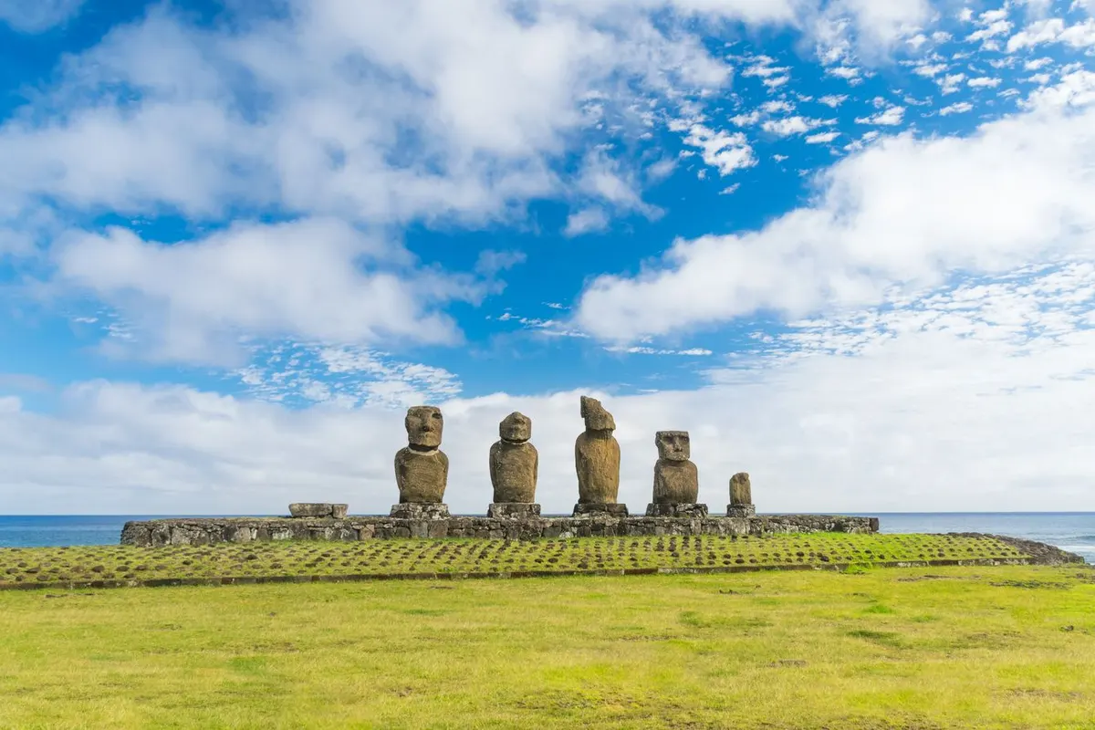
    Near Hanga Roa, watch the sun set behind the moai.

    Moai at Tahai by the sea
    Moai at Tahai by the sea

    Rano Raraku quarry

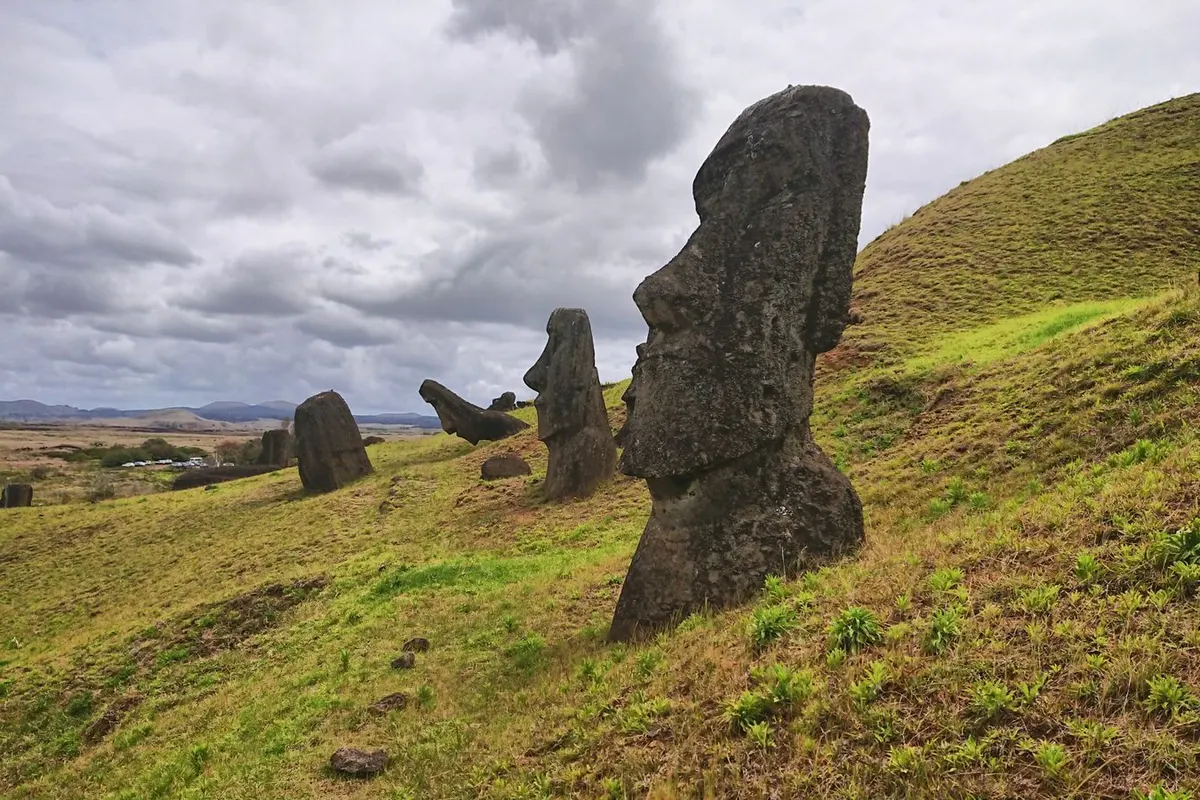
    The volcanic quarry where the moai were carved, with many unfinished statues.

    Moai on the slopes of Rano Raraku
    Moai on the slopes of Rano Raraku

    Moai by the sea

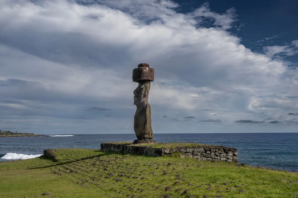
    Moai stand by the coast, some wearing red pukao topknots.

    A moai by the sea
    A moai by the sea

    Suggested itinerary

    • Arrive; Hanga Roa and the museum
    • Sunset at Tahai
    • Sunrise at Ahu Tongariki
    • Rano Raraku
    • Anakena Beach
    • Rano Kau crater and Orongo

    Where to stay nearby

    AREA 1Hanga RoaThe only town, with hotels and restaurants.
    AREA 2Ocean lodgesLuxury with sea views.
    AREA 3Campsites and guesthousesBudget-friendly stays.

    Tips for working holiday makers

    • Touching or climbing moai and sites is forbidden.
    • The park ticket covers your stay; some sites allow only one entry.
    • Prices are higher than on the mainland.
    • Entry rules can change — check before you travel.

    FAQ

    How long should I stay?

    3–5 days.

    Do I need a guide?

    Yes, at most sites.

    Can I touch the moai?

    No — touching and climbing are forbidden.

    When should I go?

    Year-round; the Tapati festival is in February.

    Planning a working holiday in Chile?Visa basics and a take-home pay calculator.
    Chile guide →

    More places to visit in Chile

    Photos: Pexels (free stock photos) Take-home pay calculator
  • The Atacama Desert Travel Guide

    The Atacama Desert Travel Guide

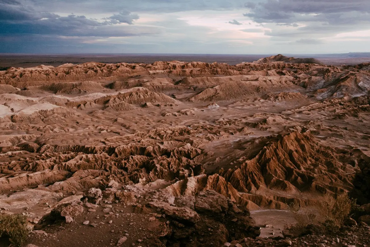
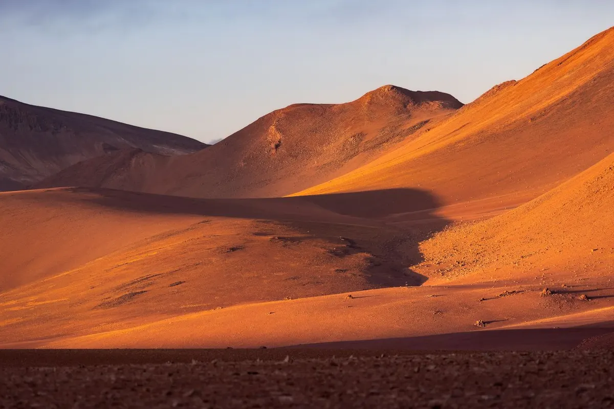
    The desert at sunset
    The desert at sunset

    Northern Chile’s Atacama is one of the driest deserts on earth. A lunar Valley of the Moon, flamingos on salt lakes, dawn geysers and some of the world’s best stargazing make it feel like another planet.

    LocationAntofagasta Region, northern Chile
    Getting thereAbout 2 hours by air from Santiago to Calama, then 1.5 hours by bus
    Best timeYear-round (March–May and September–November are most comfortable)
    Time needed3–4 days

    How to get there

    1. Fly from Santiago to Calama in about 2 hours.
    2. Shuttles take about 1.5 hours to San Pedro de Atacama.
    3. Most sights are visited on tours from San Pedro.
    4. San Pedro sits at about 2,400 m — watch for altitude sickness.

    Opening hours, prices and practical info

    AltitudeSan Pedro about 2,400 m; El Tatio about 4,300 m
    Valley of the MoonPaid; timed entry may apply
    FlightAbout 2 hours from Santiago to Calama
    StargazingBest around the new moon

    Prices and hours are from official sources as of November 2026 and may change — check the official website before you go.

    Highlights of The Atacama Desert

    The Valley of the Moon

    Wind- and water-carved rock and sand look lunar — especially at sunset.

    The Valley of the Moon
    The Valley of the Moon

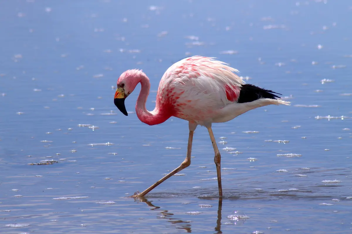
    Flamingos on the salt flats

    At Laguna Chaxa in the Salar de Atacama, pink flamingos feed in the shallows.

    A flamingo on the salt lake
    A flamingo on the salt lake

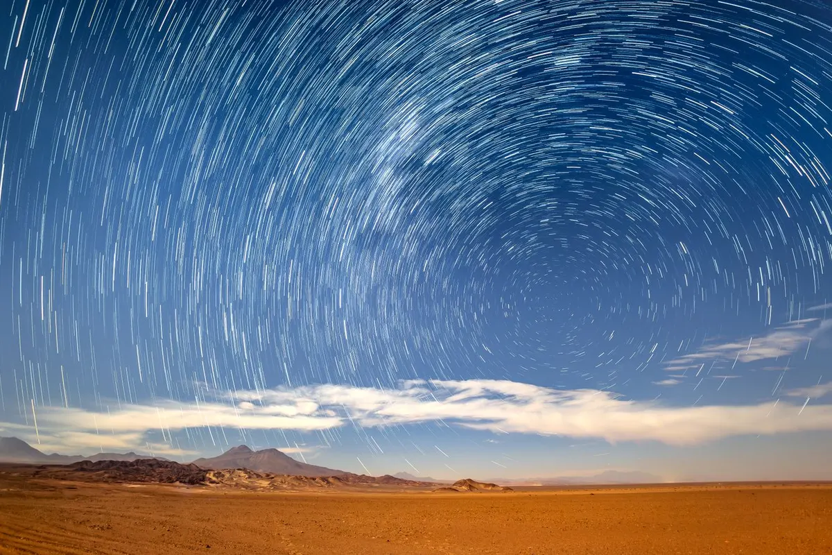
    World-class stars

    Dry, clear air reveals the Milky Way; stargazing tours are popular.

    Star trails
    Star trails

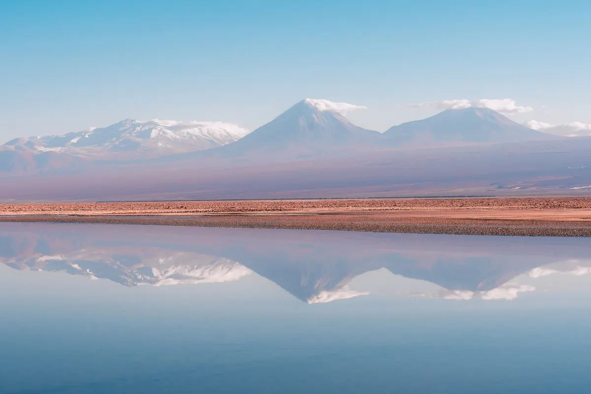
    High-altitude lakes and volcanoes

    Lakes above 4,000 m mirror the volcanoes.

    Volcanoes reflected in a lake
    Volcanoes reflected in a lake

    Suggested itinerary

    • Arrive and acclimatise
    • Sunset in the Valley of the Moon
    • Dawn tour to El Tatio geysers
    • The salt flats and flamingos
    • Stargazing tour
    • High-altitude lagoons

    Where to stay nearby

    AREA 1San Pedro de AtacamaAn adobe town with everything from hostels to lodges.
    AREA 2Desert lodgesAll-inclusive luxury.
    AREA 3CalamaThe airport town, for early flights.

    Tips for working holiday makers

    • Hot days, freezing nights — layers are essential.
    • Strong sun and dry air: sunscreen, lip balm and water.
    • Avoid alcohol and hydrate before high-altitude tours.
    • New-moon nights are best for stars.

    FAQ

    What about altitude sickness?

    Take it easy on arrival and drink plenty of water.

    How long should I stay?

    3–4 days.

    Do I need tours?

    Most sights are reached on tours.

    When should I go?

    Year-round; spring and autumn are most comfortable.

    Planning a working holiday in Chile?Visa basics and a take-home pay calculator.
    Chile guide →

    More places to visit in Chile

    Photos: Pexels (free stock photos) Take-home pay calculator
  • Torres del Paine National Park Travel Guide

    Torres del Paine National Park Travel Guide

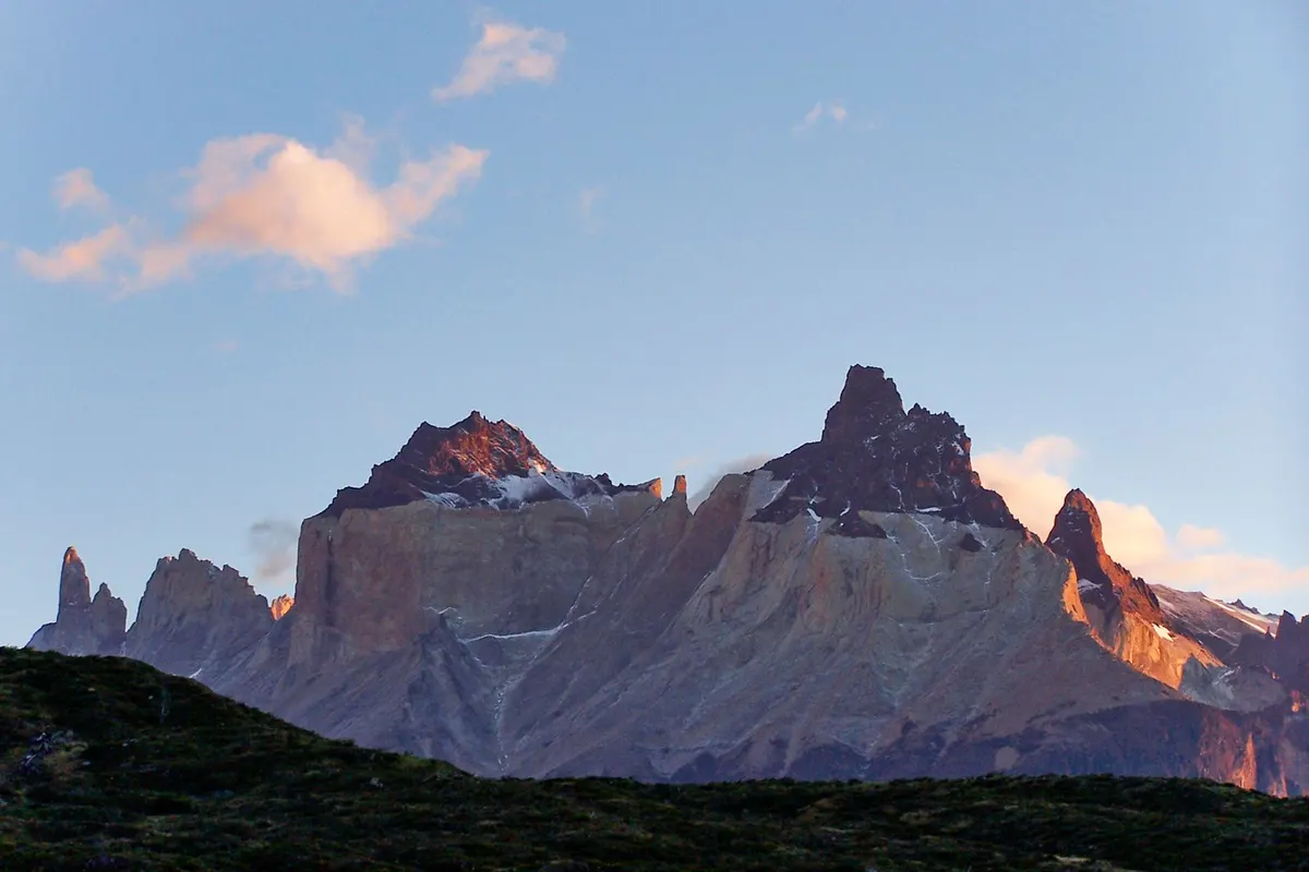
    The Cuernos at sunrise
    The Cuernos at sunrise

    In Chilean Patagonia, Torres del Paine is a dream for hikers worldwide: three granite towers, the horn-shaped Cuernos, emerald glacial lakes, herds of guanaco and wind-scoured plains — true end-of-the-earth scenery.

    LocationMagallanes Region, Chilean Patagonia
    Getting thereAbout 3.5 hours by air from Santiago to Punta Arenas; 2 hours by bus from Puerto Natales
    Best timeOctober–April
    Time neededA day trip to 5 days (the W Trek)

    How to get there

    1. Fly from Santiago to Punta Arenas or Puerto Natales.
    2. Buses take about 2 hours from Puerto Natales to the park.
    3. Park tickets must be bought online in advance.
    4. Refugios and campsites also need bookings — plan treks early.

    Opening hours, prices and practical info

    EntryPaid; buy online in advance
    W Trek4–5 days; book refugios and campsites
    FlightAbout 3.5 hours from Santiago to Punta Arenas
    Best seasonOctober–April

    Prices and hours are from official sources as of November 2026 and may change — check the official website before you go.

    Highlights of Torres del Paine National Park

    The Cuernos del Paine

    The horn-like peaks of dark and pale rock glow at sunrise.

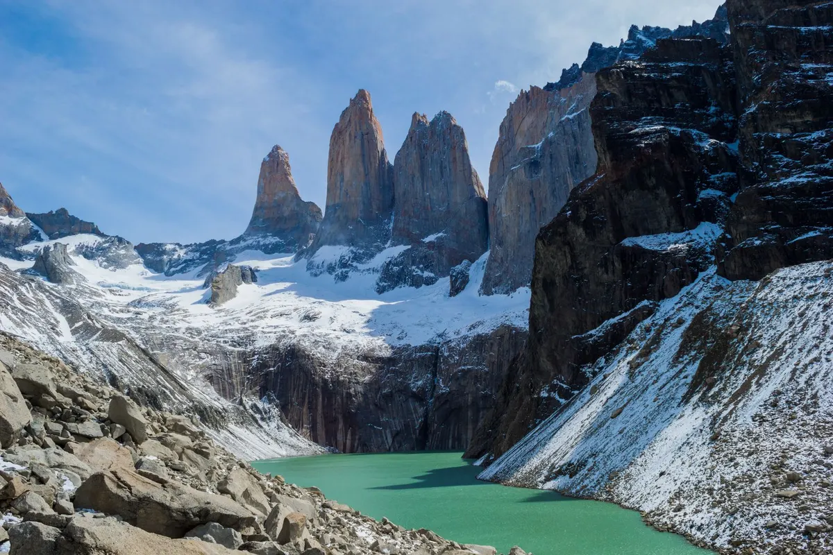
    The Towers

    After a steep climb, three granite towers rise above a glacial lake.

    The Towers and their glacial lake
    The Towers and their glacial lake

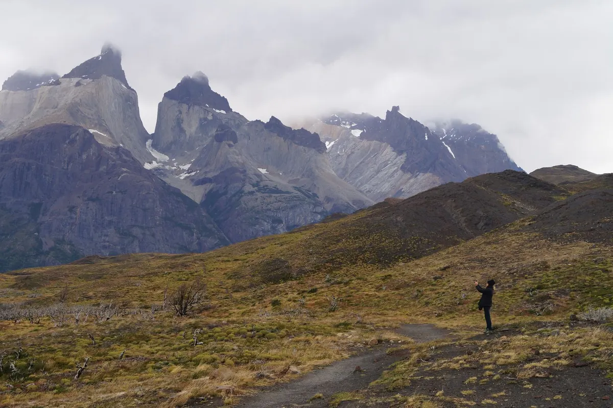
    Patagonian plains

    Hikers look tiny on the vast, windswept plains.

    A hiker on the plains
    A hiker on the plains

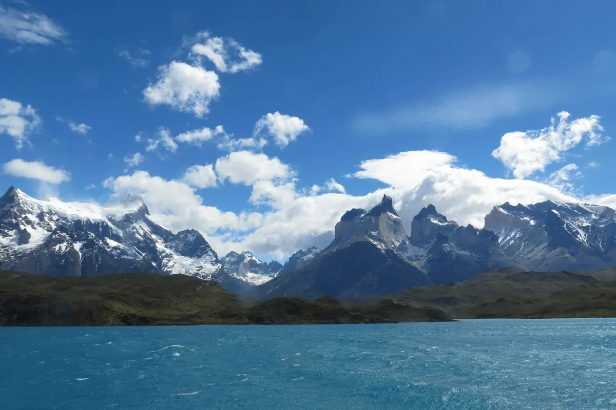
    Lakes and peaks

    Turquoise Lakes Pehoé and Nordenskjöld frame the mountains.

    Lake and mountains
    Lake and mountains

    Suggested itinerary

    • Bus from Puerto Natales to the park
    • Viewpoints around Lake Pehoé
    • Hike to the Towers viewpoint (8–10 hours return)
    • The French Valley
    • Grey Glacier
    • Back to Puerto Natales
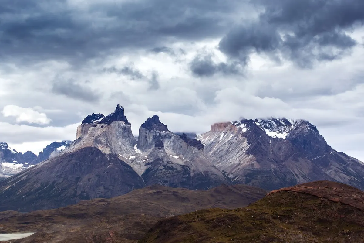
    Peaks under clouds
    Peaks under clouds

    Where to stay nearby

    AREA 1Puerto NatalesThe gateway town, with many hostels and hotels.
    AREA 2Refugios and campsitesTrekking accommodation — bookings required.
    AREA 3Park lodgesIncluding all-inclusive luxury lodges.

    Tips for working holiday makers

    • Winds can be extreme — windproof and waterproof gear is essential.
    • Weather changes many times a day.
    • Book park tickets and accommodation in advance.
    • Many combine it with El Calafate and Perito Moreno in Argentina.

    FAQ

    Can I visit in a day?

    Yes, on day tours from Puerto Natales.

    Do I need trekking experience?

    Long days need fitness; beginners can start with day hikes.

    When should I go?

    October–April.

    Do I need to book?

    Yes — park tickets and accommodation.

    Planning a working holiday in Chile?Visa basics and a take-home pay calculator.
    Chile guide →

    More places to visit in Chile

    Photos: Pexels (free stock photos) Take-home pay calculator
  • 6 Best Places to Visit in Argentina

    6 Best Places to Visit in Argentina

    Buenos Aires
    Buenos Aires

    Tango in Buenos Aires, one of the world’s greatest waterfalls, Patagonian glaciers, wine country and the end of the world — Argentina shows the planet’s variety. Here are 6 of the best places to visit on your days off or travels during a working holiday.

    Buenos Aires
    No.1

    Buenos Aires

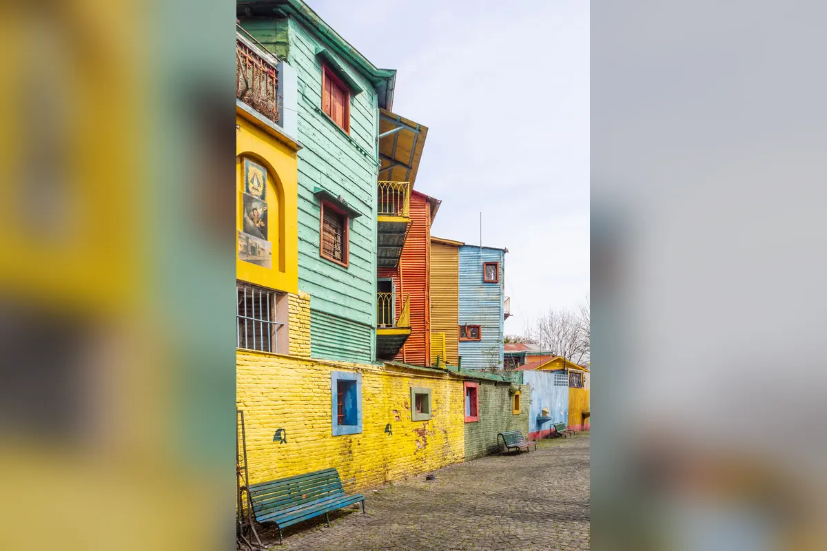
    The “Paris of South America”, Buenos Aires blends European boulevards with Latin passion. Colourful Caminito, the world-class Teatro Colón, Sunday an…

    Getting there:About 45–60 minutes by road from Ezeiza

    Read the full guide →
    Iguazú Falls
    No.2

    Iguazú Falls

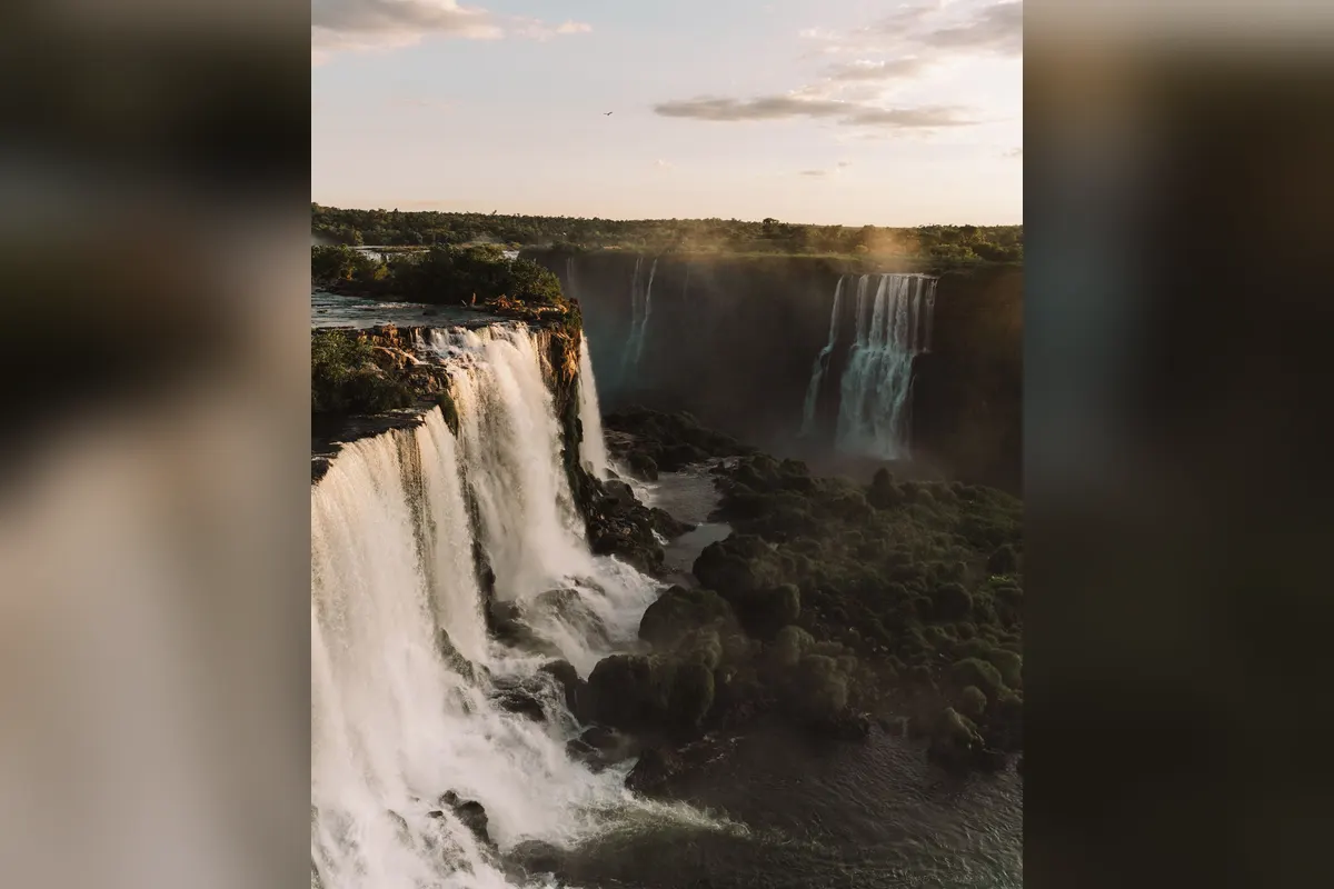
    On the Argentina–Brazil border, Iguazú Falls is one of the world’s greatest waterfall systems — about 275 cascades along 2.7 km. The thundering Devil…

    Getting there:About 1 hour 50 minutes by air from Buenos Aires to Puerto Iguazú

    Read the full guide →
    Perito Moreno Glacier
    No.3

    Perito Moreno Glacier

    In Patagonia’s Los Glaciares National Park, the Perito Moreno Glacier pushes a 60–70 m wall of blue ice into the lake — one of South America’s great …

    Getting there:About 3 hours 15 minutes by air from Buenos Aires to El Calafate, then 1.5 hours by road

    Read the full guide →
    Mendoza
    No.4

    Mendoza

    At the foot of the Andes, Mendoza is the heart of Argentine wine. Cycle between Malbec wineries or drive mountain roads with views of Aconcagua, Sout…

    Getting there:About 1 hour 50 minutes by air from Buenos Aires

    Read the full guide →
    Ushuaia
    No.5

    Ushuaia

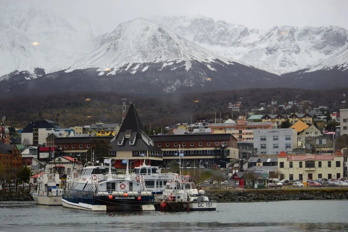
    Known as the “End of the World”, one of the southernmost cities on earth — cruise the Beagle Channel or set off for Antarctica.

    Getting there:About 3.5 hours by air from Buenos Aires

    Quebrada de Humahuaca
    No.6

    Quebrada de Humahuaca

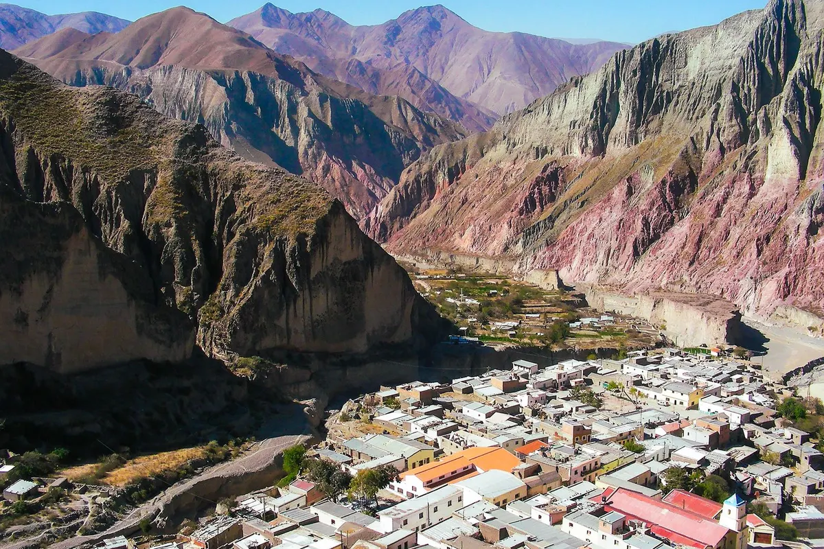
    A World Heritage valley of rainbow-striped mountains, famous for Purmamarca’s Hill of Seven Colours.

    Getting there:About 1–2 hours by bus from Jujuy (2 hours by air from Buenos Aires)

    FAQ

    What are the most popular places?

    Buenos Aires, Iguazú and Perito Moreno.

    How do I get around?

    The country is huge — fly, or use long-distance buses.

    When is the best time to travel?

    It varies; Patagonia is best October–April.

    Is it expensive?

    Inflation makes prices volatile — check the latest before you go.

    Planning a working holiday in Argentina?Visa basics and a take-home pay calculator.
    Argentina guide →

    Photos: Pexels
  • Mendoza Travel Guide

    Mendoza Travel Guide

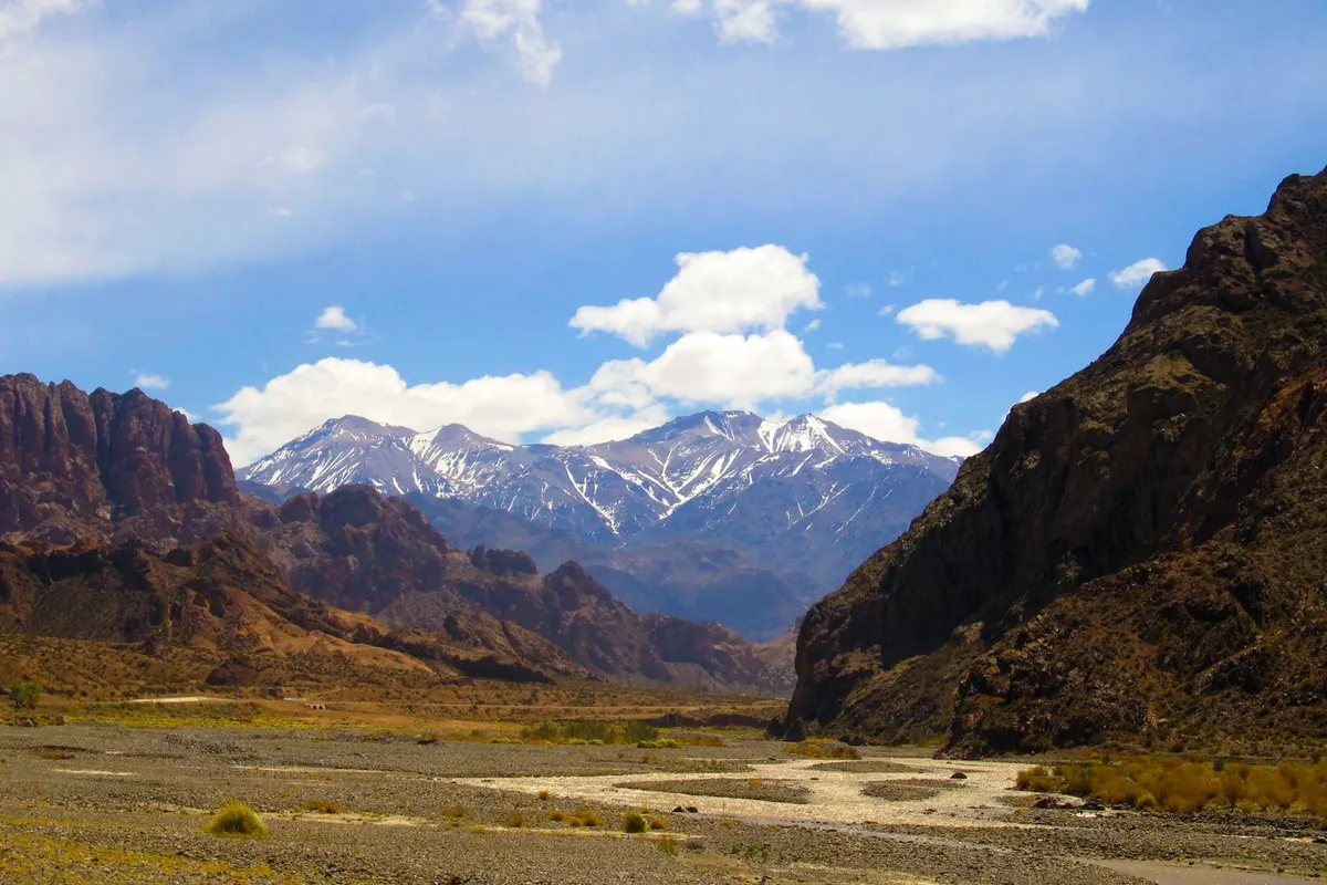
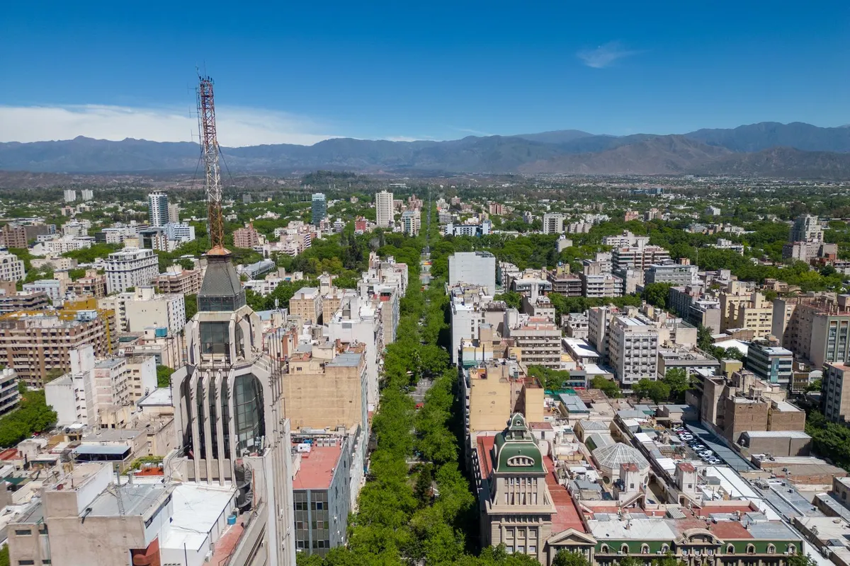
    Andes peaks and valley
    Andes peaks and valley

    At the foot of the Andes, Mendoza is the heart of Argentine wine. Cycle between Malbec wineries or drive mountain roads with views of Aconcagua, South America’s highest peak — a perfect grown-up getaway.

    LocationWestern Argentina, below the Andes
    Getting thereAbout 1 hour 50 minutes by air from Buenos Aires
    Best timeMarch–April (harvest) and October–November
    Time needed2–3 days

    How to get there

    1. Flights from Buenos Aires take about 1 hour 50 minutes.
    2. Buses and flights cross the Andes from Santiago, Chile.
    3. Tours or rental bikes reach wineries in Maipú and Luján de Cuyo.
    4. Day tours head towards Aconcagua.

    Opening hours, prices and practical info

    WineThe home of Argentine Malbec
    Vendimia festivalEarly March
    Aconcagua6,961 m (day tours to viewpoints)
    FlightAbout 1 hour 50 minutes from Buenos Aires

    Prices and hours are from official sources as of November 2026 and may change — check the official website before you go.

    Highlights of Mendoza

    Vineyards and the Andes

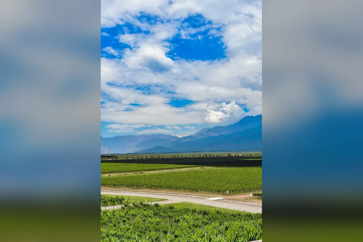
    Vineyards stretch toward the snow-capped Andes.

    Vineyards and the Andes
    Vineyards and the Andes

    Winery hopping

    Taste Malbec and enjoy lunch at a winery.

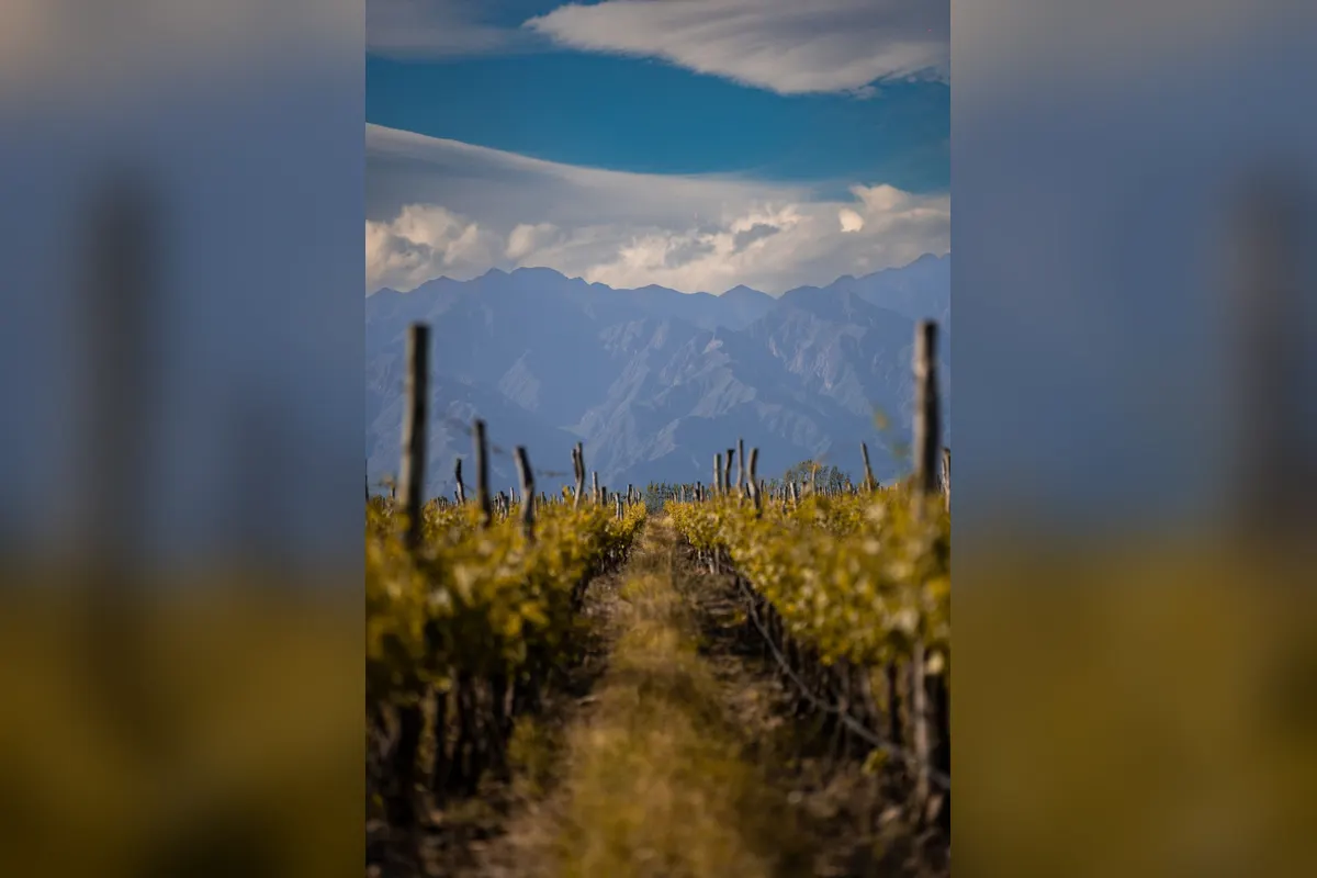
    Rows of vines
    Rows of vines

    Puente del Inca and Aconcagua

    Mountain roads lead to the natural stone bridge of Puente del Inca and viewpoints of 6,961 m Aconcagua.

    Mountains and a lake near Puente del Inca
    Mountains and a lake near Puente del Inca

    Tree-lined streets

    Irrigation channels and tree-lined avenues keep the city green.

    Mendoza city
    Mendoza city

    Suggested itinerary

    • Arrive and explore Plaza Independencia
    • Bike to Maipú wineries
    • Lunch at a winery
    • An olive oil producer
    • Andes tour with Aconcagua views
    • Asado and Malbec

    Where to stay nearby

    AREA 1Central MendozaRestaurants and tour operators.
    AREA 2Luján de CuyoStay at a wine lodge.
    AREA 3Uco ValleyLuxury lodges among mountains and vines.

    Tips for working holiday makers

    • The Vendimia harvest festival is held in early March.
    • Some shops close for siesta in the afternoon.
    • Many wineries require bookings.
    • It is dry and sunny — bring sunscreen and water.

    FAQ

    Do wineries need bookings?

    Most do.

    Can I cycle between wineries?

    Yes, in Maipú.

    When should I go?

    March–April, at harvest.

    Can I go on to Chile?

    Yes, by bus or air over the Andes to Santiago.

    Planning a working holiday in Argentina?Visa basics and a take-home pay calculator.
    Argentina guide →

    More places to visit in Argentina

    Photos: Pexels (free stock photos) Take-home pay calculator
  • Perito Moreno Glacier Travel Guide

    Perito Moreno Glacier Travel Guide

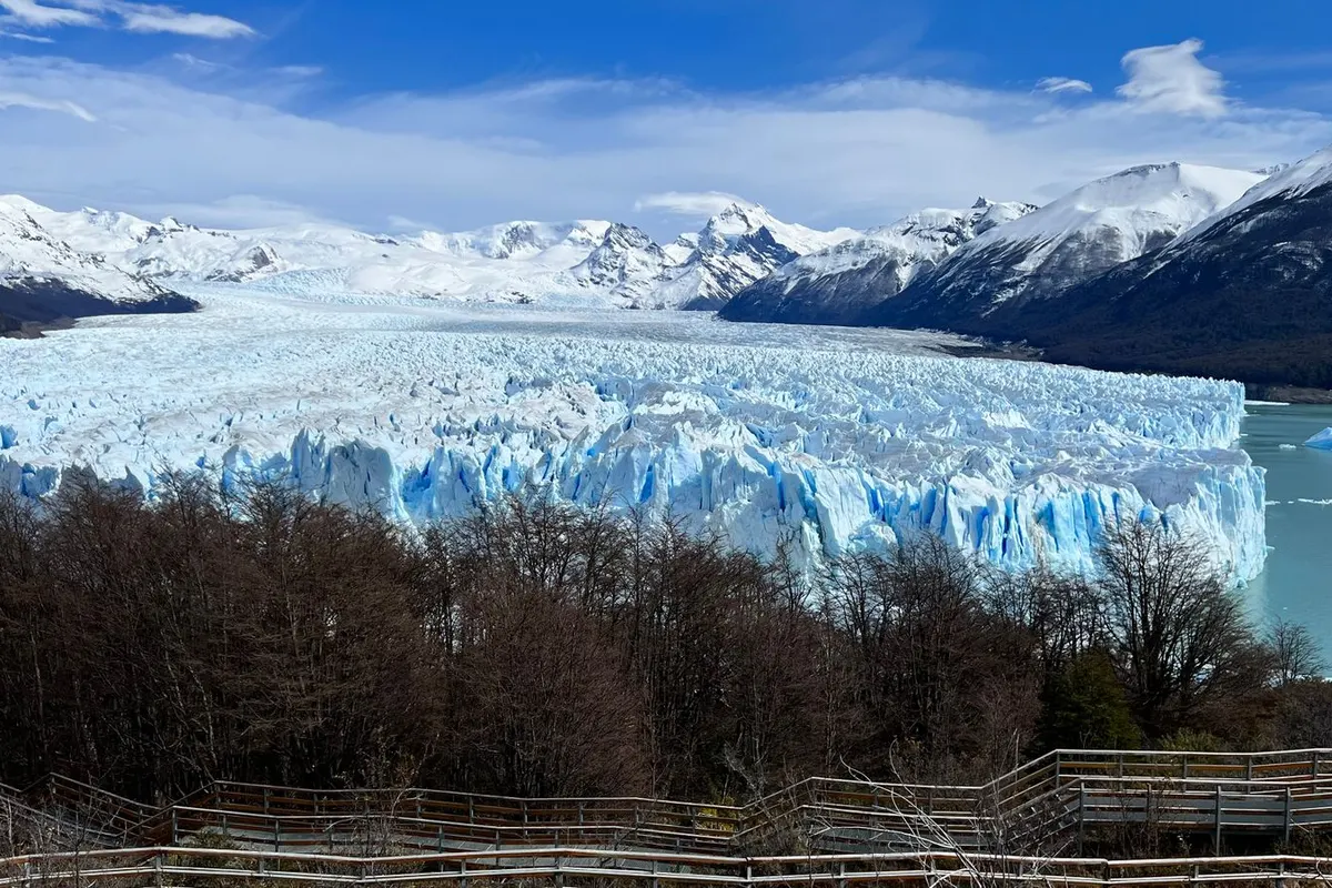
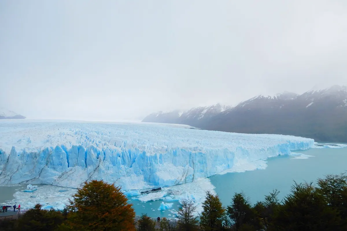
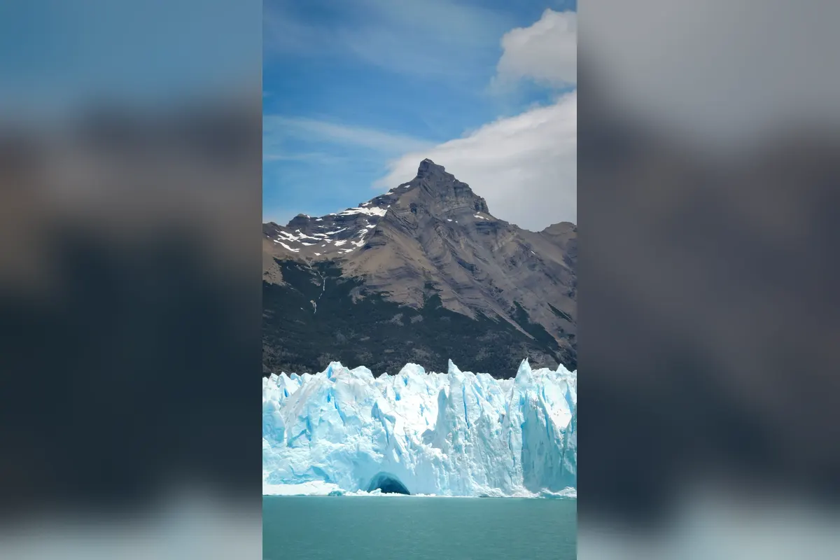
    Perito Moreno and the mountains
    Perito Moreno and the mountains

    In Patagonia’s Los Glaciares National Park, the Perito Moreno Glacier pushes a 60–70 m wall of blue ice into the lake — one of South America’s great sights. Watching ice crash into the water with a roar is unforgettable. View it from walkways or trek across it on a tour.

    LocationSanta Cruz Province, Patagonia
    Getting thereAbout 3 hours 15 minutes by air from Buenos Aires to El Calafate, then 1.5 hours by road
    Best timeOctober–April
    Time needed2–3 days

    How to get there

    1. Flights from Buenos Aires to El Calafate take about 3 hours 15 minutes.
    2. From El Calafate, buses and tours take about 1.5 hours (about 80 km).
    3. The walkways include accessible sections.
    4. Buses also cross the border to Torres del Paine in Chile.

    Opening hours, prices and practical info

    World HeritageLos Glaciares National Park (1981)
    EntryPaid (foreigner rate)
    FlightAbout 3 hours 15 minutes from Buenos Aires
    ToursBoat trips and mini-trekking are paid

    Prices and hours are from official sources as of November 2026 and may change — check the official website before you go.

    Highlights of Perito Moreno Glacier

    The glacier front

    The ice front stretches about 5 km; walkways face it head-on.

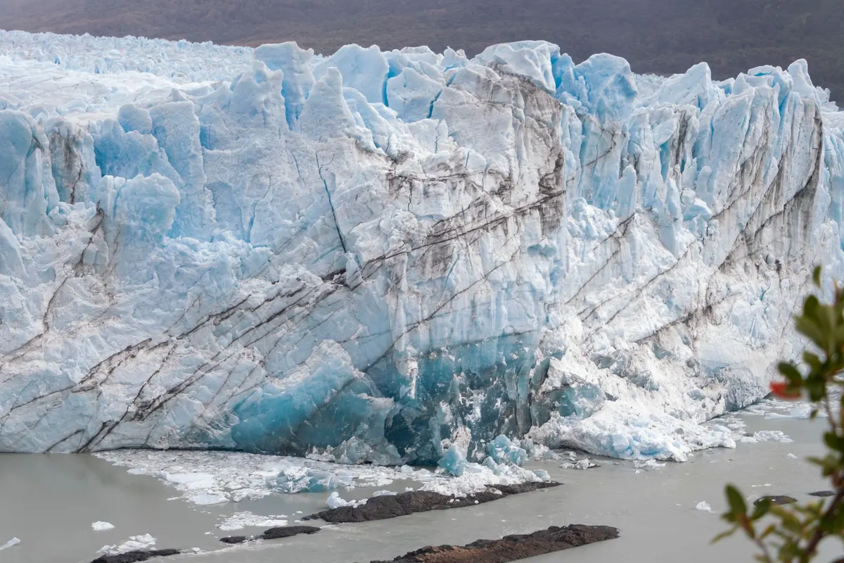
    Walls of blue ice

    The ice glows blue after centuries of compression.

    A wall of blue ice
    A wall of blue ice

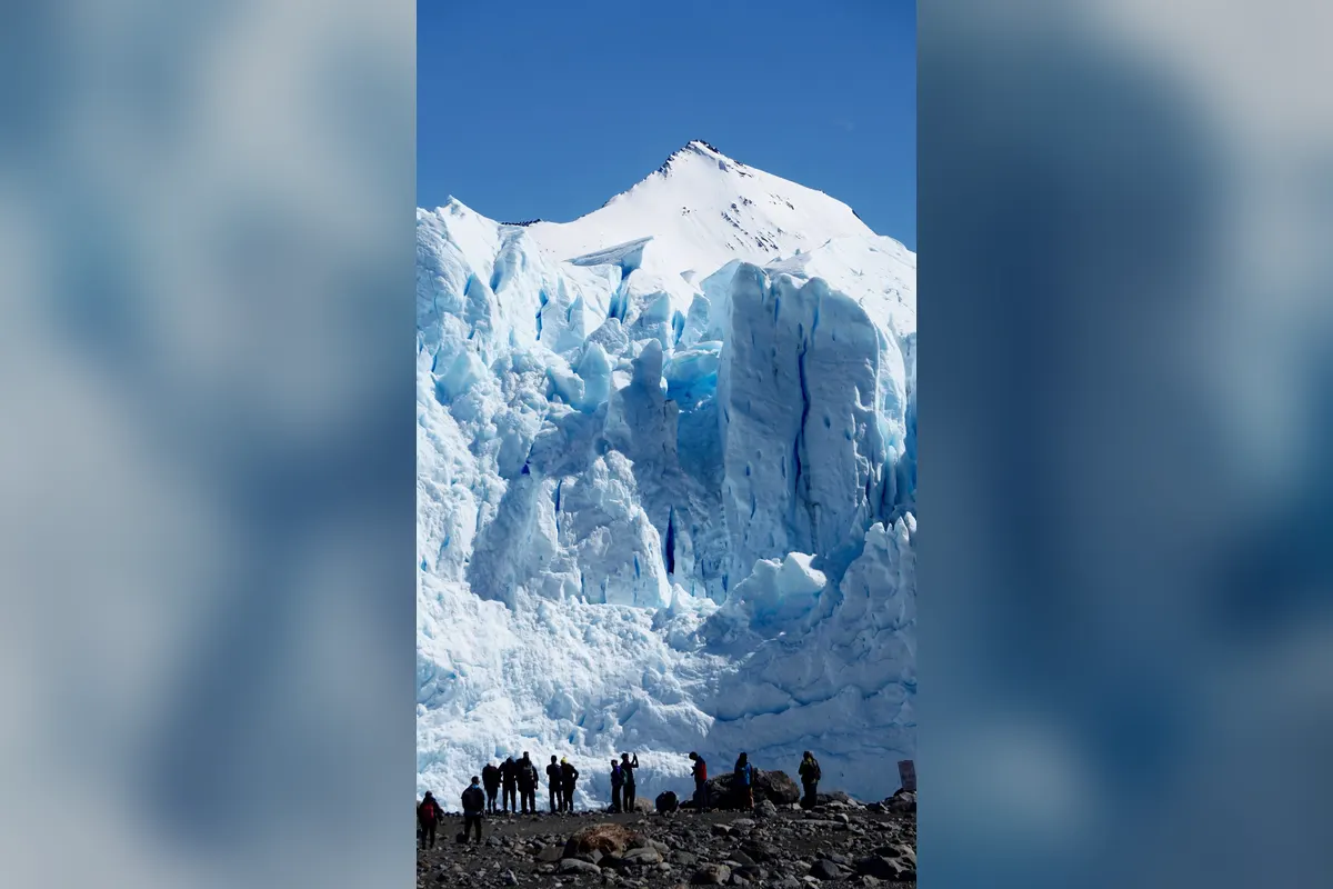
    Ice trekking

    Strap on crampons for a popular “mini-trekking” tour on the ice.

    People gazing up at the glacier
    People gazing up at the glacier

    Calving ice

    Many wait on the walkways for chunks of ice to crash into the lake.

    The glacier and forest
    The glacier and forest

    Suggested itinerary

    • Arrive in El Calafate and explore
    • Bus to the glacier
    • The walkways
    • Boat to the ice front
    • Mini-trekking tour
    • El Chaltén or a lake cruise
    The glacier and a peak
    The glacier and a peak

    Where to stay nearby

    AREA 1Central El CalafateRestaurants and tour operators.
    AREA 2Lakeside lodgesViews over Lago Argentino.
    AREA 3Near the parkSome lodges are close to the glacier.

    Tips for working holiday makers

    • Patagonia is very windy — bring a windproof jacket.
    • Even summer can be cold; dress in layers.
    • Ice-trekking tours may have age limits.
    • Park fees are higher for foreigners.

    FAQ

    Where should I stay?

    El Calafate.

    Can I walk on the ice?

    Yes, on mini-trekking tours.

    When should I go?

    October–April.

    Can I combine it with Chile?

    Yes, by bus to Torres del Paine.

    Planning a working holiday in Argentina?Visa basics and a take-home pay calculator.
    Argentina guide →

    More places to visit in Argentina

    Photos: Pexels (free stock photos) Take-home pay calculator
  • Iguazú Falls Travel Guide

    Iguazú Falls Travel Guide

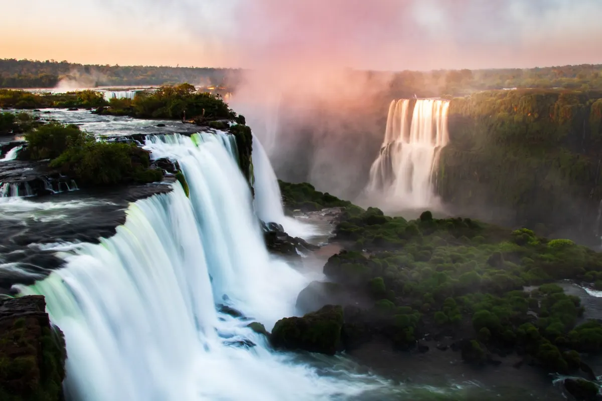
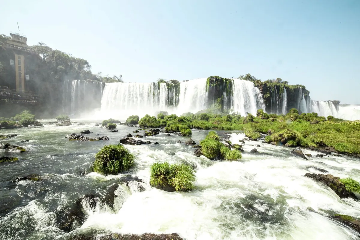
    Iguazú Falls in morning mist
    Iguazú Falls in morning mist

    On the Argentina–Brazil border, Iguazú Falls is one of the world’s greatest waterfall systems — about 275 cascades along 2.7 km. The thundering Devil’s Throat is overwhelming, and rainbows arc through the spray.

    LocationMisiones Province, northeast Argentina (Brazilian border)
    Getting thereAbout 1 hour 50 minutes by air from Buenos Aires to Puerto Iguazú
    Best timeMarch–May and August–November
    Time needed2 days to see both sides

    How to get there

    1. Flights from Buenos Aires to Puerto Iguazú take about 1 hour 50 minutes; buses take about 18 hours.
    2. The national park is 20–30 minutes from the airport or town by bus or taxi.
    3. Inside, use the Rainforest Ecological Train and walkways.
    4. Cross to the Brazilian side by bus (passport required).

    Opening hours, prices and practical info

    World HeritageIguazú National Park (1984, Argentine side)
    EntryPaid (foreigner rate)
    FlightAbout 1 hour 50 minutes from Buenos Aires
    Brazilian sideCross the border (passport required)

    Prices and hours are from official sources as of November 2026 and may change — check the official website before you go.

    Highlights of Iguazú Falls

    The Devil’s Throat

    A huge U-shaped chasm swallowing a torrent of water — seen from a walkway right above it.

    Walkways through the falls

    Argentine-side walkways take you above and below the falls.

    Cascading falls
    Cascading falls

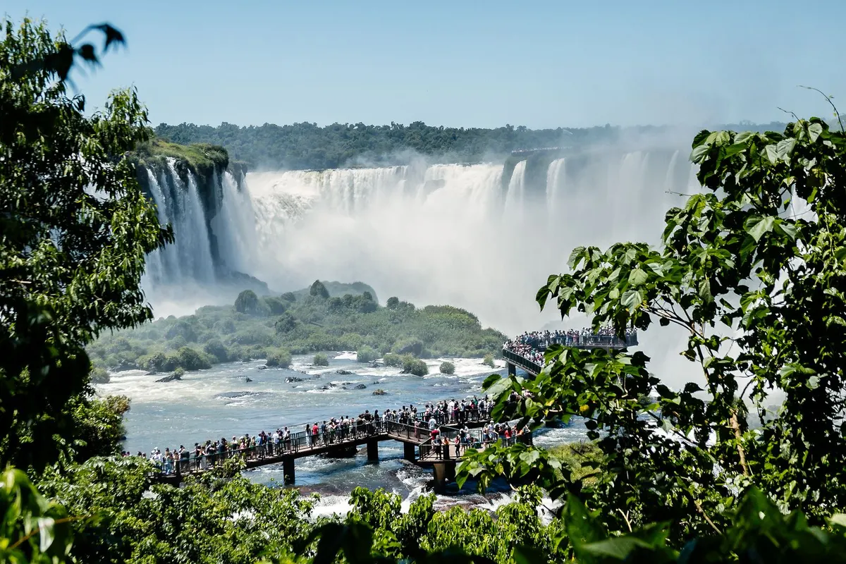
    The Brazilian panorama

    The Brazilian side offers the full panorama.

    The falls from a walkway
    The falls from a walkway

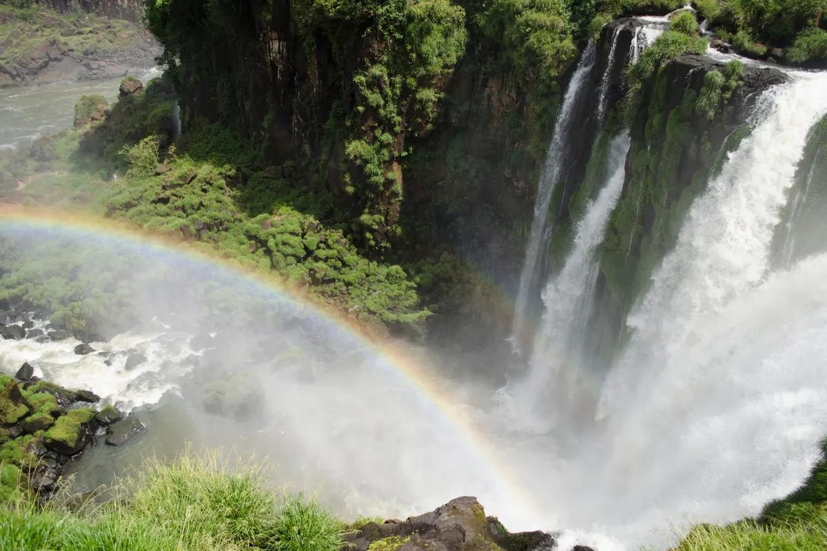
    Rainbows and rainforest

    Rainbows form in the spray, and coatis and butterflies live in the rainforest.

    Falls with a rainbow
    Falls with a rainbow

    Suggested itinerary

    • Argentine national park
    • Train to the Devil’s Throat
    • Upper and Lower Circuits
    • A boat ride under the falls (you will get soaked)
    • Cross to Brazil
    • The Brazilian panorama trail
    The falls at dusk
    The falls at dusk

    Where to stay nearby

    AREA 1Puerto IguazúThe Argentine town with plenty of hotels.
    AREA 2Inside the parkLuxury stays near the falls.
    AREA 3Foz do Iguaçu (Brazil)The larger Brazilian town.

    Tips for working holiday makers

    • You will get wet — bring rain gear or a waterproof bag.
    • Never feed the coatis; they can bite.
    • Park fees are higher for foreigners.
    • Check Brazil’s entry requirements before crossing.

    FAQ

    Argentine or Brazilian side?

    Argentina for power, Brazil for the panorama — ideally both.

    How long do I need?

    2 days for both sides.

    Will I get wet?

    Yes, on walkways and boats.

    When should I go?

    March–May and August–November.

    Planning a working holiday in Argentina?Visa basics and a take-home pay calculator.
    Argentina guide →

    More places to visit in Argentina

    Photos: Pexels (free stock photos) Take-home pay calculator
  • Buenos Aires Travel Guide

    Buenos Aires Travel Guide

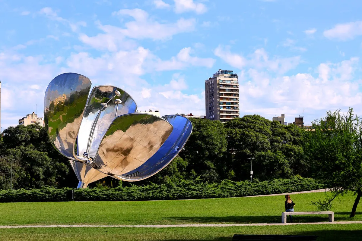
    Floralis Genérica in Recoleta
    Floralis Genérica in Recoleta

    The “Paris of South America”, Buenos Aires blends European boulevards with Latin passion. Colourful Caminito, the world-class Teatro Colón, Sunday antique markets and late-night tango — plus steak and wine — make it an electric city.

    LocationEastern Argentina on the Río de la Plata
    AirportAbout 45–60 minutes by road from Ezeiza
    Best timeOctober–December (spring) and March–May (autumn)
    Time needed3–4 days

    How to get there

    1. From Japan, fly via North America, Europe or the Middle East to Ezeiza (around 30 hours with connections).
    2. Airport buses, taxis and ride-hailing take about 45–60 minutes to the centre.
    3. Most domestic flights leave from the city’s Aeroparque Jorge Newbery.
    4. Use the Subte metro and buses with a SUBE card.

    Opening hours, prices and practical info

    Teatro ColónPaid guided tours
    Transport cardSUBE (metro and buses)
    CurrencyArgentine peso (ARS)
    SafetyTake care outside La Boca’s tourist area and at night

    Prices and hours are from official sources as of November 2026 and may change — check the official website before you go.

    Highlights of Buenos Aires

    Recoleta and Floralis Genérica

    Elegant Recoleta has the cemetery where Evita rests and a giant metal flower sculpture.

    Caminito, La Boca

    A port quarter of houses painted in ship colours, with tango dancers in the street.

    Colourful houses in Caminito
    Colourful houses in Caminito

    The Congress and Plaza de Mayo

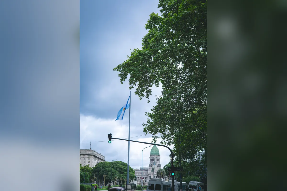
    From the green-domed Congress to the Casa Rosada on Plaza de Mayo, grand buildings line the avenues.

    The Congress and flag
    The Congress and flag

    Nights and tango

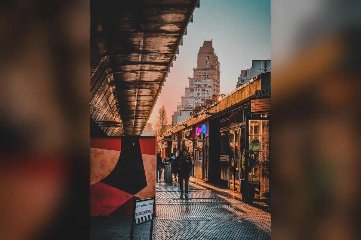
    Nights start late — dinner after 9pm, then a tango show or a milonga.

    The city at dusk
    The city at dusk

    Suggested itinerary

    • Plaza de Mayo and the Casa Rosada
    • A Teatro Colón tour
    • Parrilla lunch
    • Stroll Caminito
    • Recoleta Cemetery and parks
    • Tango show and dinner
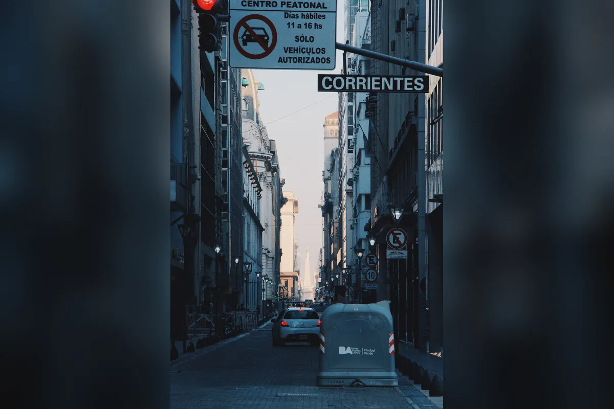
    Avenida Corrientes
    Avenida Corrientes

    Where to stay nearby

    AREA 1PalermoTrendy cafés and restaurants.
    AREA 2RecoletaElegant and relatively safe.
    AREA 3San TelmoCobbles and antiques, with a Sunday market.

    Tips for working holiday makers

    • Argentina uses the peso (ARS); inflation is high, so check rates and payment methods before you go.
    • Foreign cards may get a favourable rate, making card payment worthwhile.
    • Stay within the tourist area of La Boca and avoid it at night.
    • Spanish makes work and daily life much easier.

    FAQ

    How do I get from the airport?

    About 45–60 minutes by bus or taxi.

    Is it safe?

    Fairly, in tourist areas — watch for pickpockets and bag snatchers.

    What should I eat?

    Asado, empanadas and dulce de leche.

    How long should I stay?

    3–4 days.

    Planning a working holiday in Argentina?Visa basics and a take-home pay calculator.
    Argentina guide →

    More places to visit in Argentina

    Photos: Pexels (free stock photos) Take-home pay calculator